
MMRI Projects
Explore our past and present projects and get to know about the great work we do.
Research Projects Uncover Hidden Histories Beneath Land and Sea
From Washington, D.C. to the Mississippi Delta, graduate students at the Mississippi Mineral Resources Institute (MMRI) are leading innovative research into the Earth’s subsurface. These projects use advanced tools—from ground-penetrating radar to acoustic imaging systems—to explore geologic faults beneath national landmarks, evaluate groundwater safety, analyze energy resources, and inform responsible land use and development. Each study not only enhances scientific understanding but also addresses real-world challenges across the region and beyond.
Current Projects
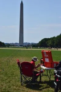
Using geophysics to understand the shallow geologic framework beneath the National Mall and Memorial Parks of Washington, D.C. and map the trend of a Quaternary fault
M.S. Thesis Project for Kristian Macias, M.S. Candidate in Geology
This project used ground penetrating radar, electrical resistivity, and refraction microtremor seismic (ReMi) to map a fault inferred to lie under our nation’s capital on published USGS maps.
Calibrating Subsurface Interpretations of Airborne Electromagnetic Data for the Mississippi Valley in Northeastern Arkansas using Multi-proxy data from Continuous Cores and Optically Stimulated Luminescence Dating
M.S. Thesis Project for Jodi Messick, M.S. Candidate in Geology
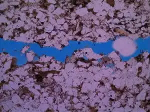
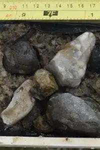
An Analysis of Reservoir Properties and Controls in the Late Jurassic-Early Cretaceous Cotton Valley Group of Jones County, Mississippi
Dissertation Project for Brightin Blanton, Ph.D. Candidate in Geology
By analyzing core samples and thin sections produced from the Cotton Valley Group in Jones County, Mississippi, MMRI hopes to improve understanding of reservoir quality, depositional environments, sedimentary facies, and pore scale processes associated with this unit. The Cotton Valley is a widespread formation deposited during the Late Jurassic to Early Cretaceous, and is considered a significant hydrocarbon play across much of the Gulf Coast region.
Previous Projects
-
Geologic Mapping of the 7.5 Minute Charleston Quadrangle, Tallahatchie County, Mississippi, and Resource Analysis of the Pre-Loess Gravel
This project, funded by the U.S. Geological Survey through the educational component of the National Cooperative Geologic Mapping Program (EDMAP). Over the course of the project a geologic engineering M.S. student learned the various geologic mapping skills and techniques field geologists use to create geologic maps. The project resulted in a 1:24,000 geologic map of the Charleston quadrangle.
Charleston EDMAP Project Summary -
Hydrologic Investigation of Subsurface Stratigraphy Using Ground Penetrating Radar in Southwestern Shelby County, Tennessee
The MMRI in collaboration with the University of Memphis acquired GPR profiles at municipal water well fields to detect potential breaches in the aquitard that would allow contaminants to be transported into the municipal water supply.
GPR Imaging of Aquitards in Memphis Project Summary -
Geology and Engineering Analysis for Economic Planning in the Blue Springs, Mississippi Area
This project acquired and summarized geological and geotechnical data for the responsible growth and development of the Blue Springs region due to the siting of a Toyota automotive manufacturing plant in the town of Blue Springs.
Blue Springs Project Overview -
Compilation of Geological Information for the Richton Salt Dome, Perry County, Mississippi
The Richton Salt Dome, located in Perry County, Mississippi, underlies parts of the town of Richton, Mississippi and represents a significant, undeveloped mineral resource. The Mississippi Mineral Resources Institute compiled geological data that can be used to promote its economic development. This compilation provides a source of information and a guide to the governmental and professional literature and includes hydrocarbon well data, sulfur exploration well data, and wells drilled by the U.S. Department of Energy contractors.
Richton Salt Dome Project Summary -
Developing an Acoustic Imaging System for the Shallow Subsurface of the Seafloor: A Polarity Preserving Chirp Sub-Bottom Profiler
The goal of the project is to develop an acoustic imaging system to investigate the shallow subsurface of the seafloor in areas with gaseous sediments.
Polarity Preserving Chirp Project Summary